




Why This Is Difficult
Land requirement is frequently under-estimated at development stage, and the reasons are mostly items that only appear once the layout is drawn.
- Ground coverage ratio drives the majority of the variation, and it is itself the output of an economic optimisation rather than a fixed value
- Module efficiency determines how much capacity fits into a covered area, so module technology changes land requirement directly
- Setbacks, access roads, drainage, fence lines and substation footprint consume land that carries no modules
- Terrain reduces usable area, since slopes, streams, wetlands and unsuitable ground are excluded after survey rather than before
- Tilt choice changes row pitch, and therefore land per megawatt, so the tilt decision has a land cost as well as an energy effect
- Land lease terms, local planning restrictions and agricultural land classification can override the engineering optimum entirely
Engineering Requirements
These are the inputs required for a defensible land requirement estimate.
- Module efficiency and dimensions for the intended technology, since capacity density follows directly from them
- Target ground coverage ratio, or the land constraint that will determine it
- Tilt or tracker configuration, since it sets row pitch and therefore row spacing
- Setback and access requirements from local planning, including road widths, fence distances and drainage provision
- Site survey identifying slopes, watercourses, protected areas and ground unsuitable for construction
- Lease terms or land cost per hectare, and any restriction on the proportion of a parcel that may be developed
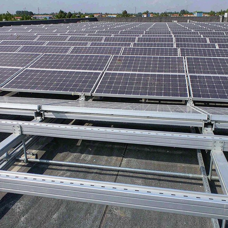
Selection guidance: calculate land requirement from the layout, not from a ratio. Acres per megawatt is an output of the design, and treating it as an input is how projects acquire land they cannot use or discover they need more.
How We Solve It
- Capacity density calculated from the actual layout, with the gross area broken into net module area and the land consumed by setbacks and infrastructure
- GCR and module efficiency carried explicitly, so land requirement can be re-estimated when either changes
- Terrain-adjusted usable area, with excluded zones mapped rather than assumed away
- Setback and access provision built into the layout from the start, so planning requirements are not discovered after land is secured
- Land requirement presented per megawatt at several GCR values, giving the development team a range rather than a single figure
- Sensitivity to module efficiency, since a technology change moves the land requirement more than most other parameters
Beyond the Structure
- Guidance on the land parcels that suit the layout and those that do not, supporting lease negotiation rather than post-hoc accommodation
- Documentation of the assumptions, so that a later capacity change can be translated into a land change without repeating the survey
Reference Benchmarks
Benchmarks below are publicly documented industry reference projects of comparable type and scale, cited to illustrate engineering practice. They are not our delivery record.
- A 200 MW tracker project in Australia where capacity density improved after module efficiency increased, reducing the land requirement by a meaningful margin at the same GCR.
- A 150 MW project in the United States where planning setbacks and access requirements consumed a larger land fraction than the array design itself.
- A 100 MW site in Spain where terrain exclusion reduced usable area enough to make a lower GCR economically preferable to retaining the original capacity target.
Standards and Compliance
- EN 1991-1-3 / ASCE 7 snow and ice load cases matched to your design return period
- IEC 61215 / IEC 61730 for module clamping zone and frame compatibility
- EN 1090 / AISC steelwork execution classes with weld procedure qualification records
- ISO 1461 galvanizing, ISO 12944 paint systems where duplex coating is specified
- ISO 9001 production quality management, batch traceability to heat numbers
- Local building code and permitting documentation support for your jurisdiction
Quality Assurance
Every batch ships with mill certificates, coating-thickness logs and bolt records; welds follow EN 1090 or AISC execution classes. Structure warranty runs to 10 years against a 25-30 year service design life, and spare-part packages are documented so year-12 repairs do not depend on year-1 memory.
Documentation You Receive
Documentation is built for audits, not decoration: structural calculation notes stating load cases and standards used; foundation design basis mapped to your geotechnical report; material certificates for steel and fasteners; galvanizing certificates with measured coating thickness per batch; assembly drawings with torque tables; and packing documentation matched to container manifests. For financed projects we add lender-format compliance statements; for public tenders we respond to documentation schedules line by line.
Service Life and Maintenance Planning
The economics of mounting systems are decided at year eight, not at signing. Galvanizing weight, fastener coating class and edge protection determine whether the year-eight inspection finds tight hardware or rust streaks. We publish expected first-maintenance intervals by environment class and back them with batch coating records, so warranty conversations start from data.
Cost and Commercial Considerations
- Acres per megawatt is not a cost, but it determines land cost, and land cost per hectare varies by more than an order of magnitude between markets
- Items that consume land without carrying modules, such as setbacks, roads and drainage, are a real cost with no revenue attached
- Over-estimating land requirement at development stage ties up capital in land that may not be developable, while under-estimating it delays the project
- Module efficiency improvements reduce land per megawatt, which is often worth more than the module price premium that delivers it
- Land cost is fixed for the layout, so the GCR and efficiency decisions that determine density are among the highest-leverage choices in development
Frequently Asked Questions
How many acres per megawatt should we plan for?
What affects capacity density most?
Should we calculate land before or after the layout?
Does a tracker use more land than fixed-tilt?
How does terrain change the land requirement?
Related Guides and Application Pages
Continue with the pages closest to your project type.
What We Need to Quote
- Target capacity and the intended module technology with efficiency data
- Site boundary survey or topographic mapping of the parcel
- Local planning requirements for setbacks, access and fencing
- Land cost or lease terms, and any development restriction on the parcel
Talk to a Structure Engineer
Send the target capacity, module technology and site boundary, and we will return a capacity density estimate with the land fraction consumed by setbacks and infrastructure shown separately.
